Garmin GPSMAP 65S Handheld GPS Device
$115.67The Garmin GPSMAP 65S is a multi-band/multi-GNSS handheld device with sensors.

Showing 25–36 of 95 results


The Garmin GPSMAP 65S is a multi-band/multi-GNSS handheld device with sensors.

A step up from it’s little brother the Field, the Ranger MS is the go-to tool for most map work on the planet. A longer base plate, magnifying lens and luminous markings build on the strengths of the entry-level model to complete this classic compass model. All Silva compasses include a pamphlet explaining their 1-2-3…

Cicerone guidebook to 50 day walks in the Mont Blanc region near Chamonix and Courmayeur, plus outlines of 4 multi-day treks around both sides of the Mont Blanc massif. The walks range from 3 to 20km and cover a variety of terrains from easy valley walks to more challenging routes over boulders, scree and on…

Silva’s Ranger SL MS is the smallest ‘real’ compass you’ll find this side of Timbuktu.Everthing is downsized but none of the practicality has been lost. The SL keeps measurements in mm and inches and even has a pin-on function so you don’t have to worry about fishing it out every few minutes. All Silva compasses include…

Cicerone’s guidebook has route descriptions for 100 day walks to suit alpine walkers of all abilities, with suggestions for some hut-to-hut tours. These routes take you through breathtaking scenery in the Maritime Alps, Julian Alps, Gran Paradiso, the Turnitzer Alps, Bernese Oberland, the Kitzbuheler Alps and the Dolomites of South Tirol.

Cicerone guidebook for walking the Tour of Mont Blanc, one of the world’s classic treks. The 170km TMB route typically takes 11 days and is described in both anti-clockwise and clockwise directions, with optional variants. Includes information about refuges and facilities and a separate booklet showing the entire route on IGN 1:25,000 maps.

Hema’s map of the Northern Territory that has camping and rest areas, 24hour fuel and points of interest. On the reverse are through road maps of Darwin and Alice Springs, and a map of the greater Darwin region. For trip planning, there is a national park matrix and contact details for information centres.

Journey along dramatic escarpments, across gorgeous rivers and through remote bushland on one of Australia’s historic long-distance walks: The Six Foot Track. This full-colour guide outlines all the info you’ll need to tackle this 44km Blue Mountains classic, including maps, estimated times, details on historic points-of-interest, possible accommodation along the hike and even public transport…

Five walks in and around Jervis Bay, New South Wales suitable for all ages.

The excellent Cicerone guidebook to walking the Camino dos Faros, the way of the lighthouses on Spain’s Galician coast. The 200km route is described across eight stages and takes in some of the area’s most enchanting coastal scenery. Incorporates some challenging walking.


The Cairns to Broome map has all the the info you need for planning this epic road trip. From national parks maps, to fuel locations, caravan parks, info centres and adventure ideas it has it all. It comes with comprehensive info on amazing attractions along the way, this is THE map to plan a Cairns to Broome…


This is one of a series of excellent guide books from the Cicerone. Their guides are an inexpensive option for hikers heading all over the world looking to explore the world’s best walks and treks, mountains and cycle routes. This book covers the Pacific Crest Trail (PCT), an epic 2650 mile hike from California’s Mexican border to…
End of content
End of content
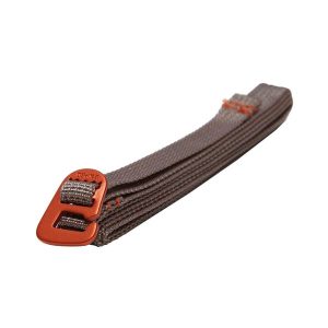 Accessory Strap UL 120cm (pair)
1 × $56.98 Mont Blanc Walks - Day and Multi Day
1 × $60.06
Accessory Strap UL 120cm (pair)
1 × $56.98 Mont Blanc Walks - Day and Multi Day
1 × $60.06 Subtotal: $117.04