Walking & Cycling Canberra’s Centenary Trail introduces the best day walks and cycles for visitors and residents alike, ranging from leisurely urban strolls to the more rugged tracks deep in the bush. Detailed descriptions and maps help the reader explore the parks, bushland, lakes, rivers and most interesting urban areas along the way. The book…
All the mapping you need to complete the 95 mile (153km) West Highland Way, an official Scottish Long Distance Route from Milngavie near Glasgow to Fort William. Showcasing the wild beauty of western Scotland, the trail is a journey from the lowlands to the highlands, passing Loch Lomond then crossing Rannoch Moor before finishing in…
Have you ever thought I just want a map of NSW, the whole state, on one page for my wall to plan my trips! Well, you’ve found it! The reverse side has a more detailed view of the coast from Batemans Bay up to Forster, including campsites and lookouts for Barrington Tops, Wollemi National Park,…
These maps highlight the walking tracks and features tourist information along with general topographic detail and is essential for walkers. The notes on the reverse side introduce visitors to the vegetation, land forms, animals, history of the area, bushwalking tips, safety essentials and booking requirements. Scale: 1:100,000.
John Chapman and his co-authors spend their lives hiking all over this great land and writing guide books so the rest of us can follow them. Through years of refinement John & Co’s books are well laid-out and colourfully illustrated that detail routes, background, safety, trip planning and further reading.
Had plans to do the Camino this year Maybe your Everest Base Camp trek was cancelled Don’t worry! The Great North Walk is just what you’re looking for! The 250km walk between Newcastle and Sydney is stunning, challenging and right in your backyard. This new section-by-section guide includes full-colour photography, accurate maps, and info on…
Silva’s Ranger SL MS is the smallest ‘real’ compass you’ll find this side of Timbuktu.Everthing is downsized but none of the practicality has been lost. The SL keeps measurements in mm and inches and even has a pin-on function so you don’t have to worry about fishing it out every few minutes. All Silva compasses include…
This is one of a series of excellent guide books from the Cicerone. Their guides are an inexpensive option for hikers heading all over the world looking to explore the world’s best walks and treks, mountains and cycle routes. This is a guide to walking the John Muir Trail through California’s High Sierra from Yosemite (El Capitan and…
This Cicerone guidebook gives stage-by-stage directions for the Central Camino, starting from Lisbon, Porto or Tui, the Coastal Camino between Porto or Vigo, and the Spiritual Variant route from Pontevedra to Redondela. It also describes link routes that can be used to swap from one route to another. Detailed route guidance and maps are accompanied…
Hema’s iconic large map of Australia is ideal as a trip planning tool and travel companion. Marked on the map are localities, the major road network, distances and major national parks. The map also shows localities, the major road network, distances and major national parks. The visual appeal makes it perfect as a decorative map…
Six Foot Track Map, Informative map covering the 46km long trail from Katoomba to Jenolan Caves. Shows intermediate distances, campsites, facilities and extensive track notes. A NSW Government publication. This map can be laminated and refolded for extra durability in the field.
A walker’s guide to the Bogong High Plains, Mt Bogong, Mt Feathertop and Mt Buffalo by Glenn van der Knijff. With its unique user-friendly layout, Victoria’s Bogong High Plains will become an essential reference guide for all walkers. This full-colour, 96 page walking guide is produced in a handy A5 format. Includes
















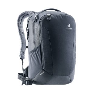 Giga
Giga 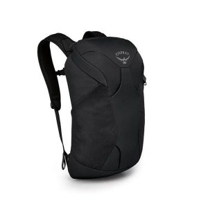 Farpoint Farview Travel Daypack
  Walking the Camino Dos Faros