Journey along dramatic escarpments, across gorgeous rivers and through remote bushland on one of Australia’s historic long-distance walks: The Six Foot Track. This full-colour guide outlines all the info you’ll need to tackle this 44km Blue Mountains classic, including maps, estimated times, details on historic points-of-interest, possible accommodation along the hike and even public transport…
The ACR ResQlink 400 Personal Locator Beacon is a small, lightweight and buoyant personal locator beacon. Engineered with military durability and equipped with ResQlink’s satellite precision this unit will not let you down if or when you need it most. You can trust this unit in any environment be it land, sea or sky to…
These are the official 1:25 000 scale topographical maps from the NSW government Land & Property Division, covering the most outstanding areas of the state on a well-produced, reversible, fold-out map perfect for hikers.
Had plans to do the Camino this year Maybe your Everest Base Camp trek was cancelled Don’t worry! The Great North Walk is just what you’re looking for! The 250km walk between Newcastle and Sydney is stunning, challenging and right in your backyard. This new section-by-section guide includes full-colour photography, accurate maps, and info on…
This touring map traverses Australia from Melbourne to Adelaide (1:900,000) and features an inset map of the Great Ocean Road (1:450,000). The latter map pinpoints significant locations along the route with tourist information attached and is accompanied by other useful information to illuminate the journey. Through-road maps of Melbourne to Adelaide are also included.
Walking & Cycling Canberra’s Centenary Trail introduces the best day walks and cycles for visitors and residents alike, ranging from leisurely urban strolls to the more rugged tracks deep in the bush. Detailed descriptions and maps help the reader explore the parks, bushland, lakes, rivers and most interesting urban areas along the way. The book…
This Cicerone guidebook presents 75 day walks of 1 to 26km in South Africa’s Maloti-Drakensberg Park, a UNESCO World Heritage Site. Located in KwaZulu Natal and easily accessible from Johannesburg, Harrismith, Pietermaritzburg and Durban, the region boasts dramatic cliffs, gorges and waterfalls, abundant wildlife and 2000 year old rock paintings.
John Chapman and his co-authors spend their lives hiking all over this great land and writing guide books so the rest of us can follow them. Through years of refinement John & Co’s books are well laid-out and colourfully illustrated that detail routes, background, safety, trip planning and further reading.
The Budawangs stands as one of Australia’s most spectacular and distinctive wilderness areas. Using modern elevation, vegetation and trail data, The Budawangs finally delivers a map of quality and accuracy befitting this renowned bushwalking destination. Key features include:
The excellent Cicerone guidebook to walking the Camino dos Faros, the way of the lighthouses on Spain’s Galician coast. The 200km route is described across eight stages and takes in some of the area’s most enchanting coastal scenery. Incorporates some challenging walking.
These Tasmanian maps are recommended for regional planners and visitors intending to travel a little off the beaten track. The map is popular with drivers, cyclists and people wanting a regional overview of an area. The maps are available in folded and flat form and may be joined together to create an impressive wall map.
Hema’s updated WA State Map is comprised of the most detailed information, which has been verified by Hema Map Patrol. It is printed on waterproof paper and includes a full index of locations, making it durable and easy to use for both navigation and inspiration. On the reverse side of the maps are through road…
















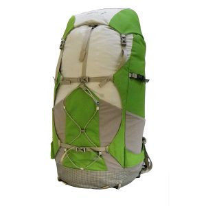 Peak Aspiration Medium 55L Pack
  Short Walks Southern Tasmania - Chapman