Looking to do some fun stuff in the Wilsons Promontory region This is the map for you! This map features detailed walk descriptions, including day walks such as the Lilly Pilly Gully, Mt. Oberon and Obern Bay, and overnight walks including Southern Prom and Northern Prom walks. Information on other fun recreational activities including camping,…
The design of the Tasmap 1:50 000 Map Series provides a clear and accurate portrayal of topographic information, with symbols and map content giving enhanced depiction of buildings, hill shading and a simplified classification of vegetation.
Silva’s Expedition is the front-runner in their series of world-leading compasses.The base plate model has four different map-measuring scales for ultimate versatility, a screw for built-in declination adjustment and a rugged Dryflex housing. This is the perfect mid-range compass for heavy expeditions. All Silva compasses include a pamphlet explaining their 1-2-3 map-reading system which demystifies…
Cicerone guide details the Camino del Norte and Camino Primitivo pilgrim routes. The Camino del Norte covers 820 kms and takes you from Irún via Bilbao and Santander takes around 5 weeks to complete. The 355km Camino Primitivo takes about 2 weeks. The book also includes the Camino Finisterre from Santiago to the coast.
The Grampians region is one of the most popular destinations in Victoria for bushwalking and outdoor recreation. This detailed topographic map contains the latest road and walking trail networks, including the first stage of the new Grampians Peaks Trail, and locations of all the recreation sites in the region. A detailed (1:25,000) map of Halls…
John Chapman and his co-authors spend their lives hiking all over this great land and writing guide books so the rest of us can follow them. Through years of refinement John & Co’s books are well laid-out and colourfully illustrated that detail routes, background, safety, trip planning and further reading.
These Tasmanian maps are recommended for regional planners and visitors intending to travel a little off the beaten track. The map is popular with drivers, cyclists and people wanting a regional overview of an area. The maps are available in folded and flat form and may be joined together to create an impressive wall map.
Best Walks of NSW Mid North Coast covers the mid-north of NSW from south of Port Macquarie to Yamba and boasts a huge range of beautiful environments, making the region perfect for exploring on foot. This book introduces the best walks for visitors and residents alike, ranging from leisurely cliff-top and beach strolls to the…
It’s a map case! You know, you put maps inside to keep them dry, but you can still read them! Actually it’s more than that. The touchscreen compatible TPU screen means that you could conceivably read a map displayed on your tablet, and manipulate it. And don’t fret – its waterproof rating is IPX7 so…
Guidebook to the GR10, a 955km trek across the French Pyrenees from Hendaye on the Atlantic Coast to the Mediterranean coast at Banyuls-sur-Mer. Described in 55-day stages of 7-27km, the route can be completed in its entirety, usually in around 45 days, or in shorter sections using the bus and rail links found throughout the…
Hema’s updated WA State Map is comprised of the most detailed information, which has been verified by Hema Map Patrol. It is printed on waterproof paper and includes a full index of locations, making it durable and easy to use for both navigation and inspiration. On the reverse side of the maps are through road…
Cicerone guidebook to 50 day walks in the Mont Blanc region near Chamonix and Courmayeur, plus outlines of 4 multi-day treks around both sides of the Mont Blanc massif. The walks range from 3 to 20km and cover a variety of terrains from easy valley walks to more challenging routes over boulders, scree and on…
















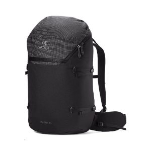 Konseal 40 Backpack
 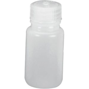 Nalgene Wide Mouth Container
  Walking in the Drakensberg