Hema’s updated WA State Map is comprised of the most detailed information, which has been verified by Hema Map Patrol. It is printed on waterproof paper and includes a full index of locations, making it durable and easy to use for both navigation and inspiration. On the reverse side of the maps are through road…
With its small size and precise needle, the Silva Pocket compass is a handy, compact compass that is perfect to bring along on your hike. While not designed for advanced navigation, it is a great aid if you need to find the right basic direction quickly or use it as a backup for a more…
Cicerone’s excellent guidebook to 22 multi-day treks in the Himalayan Kingdom of Bhutan, including the Jhomolhari, Druk Path and Dagala treks. The trails vary from 2 to 23 days long. The routes are mostly in western and central Bhutan, and range from easy to strenuous depending on the length, altitude and difficulty. Includes advice on cultural…
John Brierly is one of the acknowledged experts in walking the pilgrim’s route of the Camino Frances, Way of St. James, or Camino de Santiago, in northern Spain. For walkers who do not wish to carry the full guide book, and who only require maps, John has produced this map kit, with full daily stage…
A thoroughly revised fourth edition of the bestselling Blue Mountains Best Bushwalks is the perfect companion for the bushwalking fan. The book features: 67 different walks, varying in length from 30 minutes to two days, accurate, full colour maps and step by step directions, detailed walk statistics including distance, total ascent/descent, grade and estimated time,…
These light but strong polymer waterproof bags from Lifeventure will protect anything you care to put in them from water damage, scratching, religious conversion etc. The press-seal LocTop is rated to IPX8, that submersible up to 10m for 30 minutes. The large pack is designed for maps but comes with three different sized bags that…
The New Zealand North Island Map (NZ) is a 1:1,000,000 scale travel reference map of the north island of New Zealand. Marked on the mapping are points of interest, tourist routes, walking tracks and national parks for touring the island. On the reverse are city maps of Auckland, Wellington, Whangarei, Napier, Kerikeri, Hamilton, Gisborne, New Plymouth, Palmerston…
South-East of Tasmania is one of Australia’s most beautiful regions, and with its stunning scenery and iconic walking tracks it is the perfect place to experience and enjoy on foot. This guide contains a diverse range of walks to explore, including strolls around historic villages, hikes through pristine bushland and rambles along the sparkling, unspoiled…
The Exped Seal Sleeve is a range of simple and compact cases that are fully 100% Waterproof and touchscreen compatible. If your next adventure might require you to keep your phone, tablet, wallet, map, money or documents from ending up in the drink – This is the product. Exped has developed a super strong zip…
Cicerone’s comprehensive guidebook and map book to walking the 784km Camino Frances from St Jean-Pied-de-Port in southern France to Santiago de Compostela in Spain, including an additional route to Finisterre. Split into 6 sections and 36 customisable stages, the guide lists over 500 pilgrim hostels. The map book covers the entire route, which can be…
Guidebook to the GR10, a 955km trek across the French Pyrenees from Hendaye on the Atlantic Coast to the Mediterranean coast at Banyuls-sur-Mer. Described in 55-day stages of 7-27km, the route can be completed in its entirety, usually in around 45 days, or in shorter sections using the bus and rail links found throughout the…















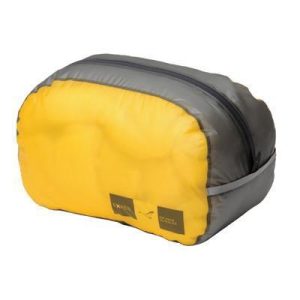 Zip Pack UL - Ultralight
  Hobarts Best Bush Coast & City Walks