Cicerone guide details the Camino del Norte and Camino Primitivo pilgrim routes. The Camino del Norte covers 820 kms and takes you from Irún via Bilbao and Santander takes around 5 weeks to complete. The 355km Camino Primitivo takes about 2 weeks. The book also includes the Camino Finisterre from Santiago to the coast.
This bestselling bushwalking guide is the perfect companion for the experienced Blue Mountains adventurer, the keen bushwalking beginner and the whole family! Written by Veechi Stuart, a former Sydney Morning Herald columnist and true Blue Mountains local, this guide includes something for everyone. Included:
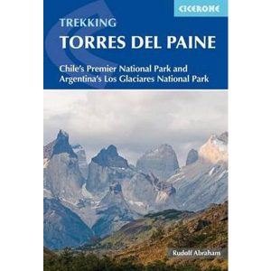
This excellent Cicerone guidebook to walking and trekking in Chile’s Torres del Paine National Park and Argentina’s Los Glaciares National Park, areas of Patagonia. Eight different walks and treks are described, including the 10-11 day Torres del Paine Circuit, one of the world’s great treks, as well as the shorter Half Circuit (4-5 days). The guide…
The Grampians region is one of the most popular destinations in Victoria for bushwalking and outdoor recreation. This detailed topographic map contains the latest road and walking trail networks, and in depth info for walking, overnight hiking, 4WD touring and other recreational activities. The map also includes a detailed inset of the Mount Abrupt and…
Printed on waterproof tyvek this tough map covers the Snowy Mountains Main Range on one side at 1:25,000 & Guthega to Round Mountain including Mt Jagungal on the other at 1:50,000 with amazing detailed representation with 10m contour intervals. Also with detailed insets of Watsons Crags, Dead Horse Gap, Blue Lk, Lady Northcote Canyon & marginal…
John Chapman and his co-authors spend their lives hiking all over this great land and writing guide books so the rest of us can follow them. Through years of refinement John & Co’s books are well laid-out and colourfully illustrated that detail routes, background, safety, trip planning and further reading.
Hema’s updated WA State Map is comprised of the most detailed information, which has been verified by Hema Map Patrol. It is printed on waterproof paper and includes a full index of locations, making it durable and easy to use for both navigation and inspiration. On the reverse side of the maps are through road…
These are the official 1:25 000 scale topographical maps from the NSW government Land & Property Division, covering the most outstanding areas of the state on a well-produced, reversible, fold-out map perfect for hikers.
Silva’s Expedition is the front-runner in their series of world-leading compasses.The base plate model has four different map-measuring scales for ultimate versatility, a screw for built-in declination adjustment and a rugged Dryflex housing. This is the perfect mid-range compass for heavy expeditions. All Silva compasses include a pamphlet explaining their 1-2-3 map-reading system which demystifies…
Cicerone’s guidebook has route descriptions for 100 day walks to suit alpine walkers of all abilities, with suggestions for some hut-to-hut tours. These routes take you through breathtaking scenery in the Maritime Alps, Julian Alps, Gran Paradiso, the Turnitzer Alps, Bernese Oberland, the Kitzbuheler Alps and the Dolomites of South Tirol.
It’s a map case! You know, you put maps inside to keep them dry, but you can still read them! Actually it’s more than that. The touchscreen compatible TPU screen means that you could conceivably read a map displayed on your tablet, and manipulate it. And don’t fret – its waterproof rating is IPX7 so…
This is one of a series of excellent guide books from the Cicerone. Their guides are an inexpensive option for hikers heading all over the world looking to explore the world’s best walks and treks, mountains and cycle routes. This book details walking the GR20 through Corsica’s high mountains. A challenging trail between Calenzana and Conca that…














 Garmin GPSMAP 65S Handheld GPS Device