A compact map of Queensland (QLD) at a scale of 1:2,500,000 from Hema, for touring throughout the state which features highways, major roads and minor roads. Marked on the map are national parks, camping areas, caravan parks, rest areas, points of interest and 24-hour fuel accompanied by a distance grid and an index.
Cicerone guidebook for walking the Tour of Mont Blanc, one of the world’s classic treks. The 170km TMB route typically takes 11 days and is described in both anti-clockwise and clockwise directions, with optional variants. Includes information about refuges and facilities and a separate booklet showing the entire route on IGN 1:25,000 maps.
Silva’s Ranger SL MS is the smallest ‘real’ compass you’ll find this side of Timbuktu.Everthing is downsized but none of the practicality has been lost. The SL keeps measurements in mm and inches and even has a pin-on function so you don’t have to worry about fishing it out every few minutes. All Silva compasses include…
This softcover coffee-table style Guidebook reveals the many hidden secrets of the Blue Mountains. Misty, snow dusted landscapes, mysterious amphitheatres, cliff-line waterfalls & waterholes, myriad bushwalking tracks leading to unexpected vistas, cliff-top sunrise brekky spots, plush Hatted restaurants & eclectic coffee shops and the extremist of extreme sports.Within this beautifully designed Guidebook, you’ll find our…
Journey along dramatic escarpments, across gorgeous rivers and through remote bushland on one of Australia’s historic long-distance walks: The Six Foot Track. This full-colour guide outlines all the info you’ll need to tackle this 44km Blue Mountains classic, including maps, estimated times, details on historic points-of-interest, possible accommodation along the hike and even public transport…
It’s no good having a map if it’s all soggy – contour lines tend to blur, transforming gentle slopes into towering cliffs. Avoid such topographical catastrophes by protecting your map in this practical map case. The welded design will protect paper from water and dust, and the TPU (thermoplastic polyurethane) is UV resistant and folds…
Looking to do some fun stuff in the Wilsons Promontory region This is the map for you! This map features detailed walk descriptions, including day walks such as the Lilly Pilly Gully, Mt. Oberon and Obern Bay, and overnight walks including Southern Prom and Northern Prom walks. Information on other fun recreational activities including camping,…
This is one of a series of excellent guide books from the Cicerone. Their guides are an inexpensive option for hikers heading all over the world looking to explore the world’s best walks and treks, mountains and cycle routes. This book details walking the GR20 through Corsica’s high mountains. A challenging trail between Calenzana and Conca that…
Cicerone’s comprehensive guidebook and map book to walking the 784km Camino Frances from St Jean-Pied-de-Port in southern France to Santiago de Compostela in Spain, including an additional route to Finisterre. Split into 6 sections and 36 customisable stages, the guide lists over 500 pilgrim hostels. The map book covers the entire route, which can be…
All the mapping you need to complete the 95 mile (153km) West Highland Way, an official Scottish Long Distance Route from Milngavie near Glasgow to Fort William. Showcasing the wild beauty of western Scotland, the trail is a journey from the lowlands to the highlands, passing Loch Lomond then crossing Rannoch Moor before finishing in…
These are the official 1:25 000 scale topographical maps from the NSW government Land & Property Division, covering the most outstanding areas of the state on a well-produced, reversible, fold-out map perfect for hikers.

















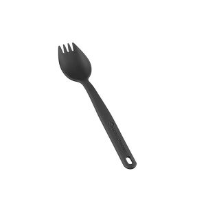 Camp Cutlery Spork
  Los Caminos Del Norte 4A2: Ruta de la Costa