Have you ever thought “I just want a map of South Australia, the whole state, on one page for my wall to plan my trips”! Well, you’ve found it wiht this map from Hema! The reverse side has a more detailed view of Adelaide’s CBD and through roads, along with additional maps of the Flinders…
The New Zealand North Island Map (NZ) is a 1:1,000,000 scale travel reference map of the north island of New Zealand. Marked on the mapping are points of interest, tourist routes, walking tracks and national parks for touring the island. On the reverse are city maps of Auckland, Wellington, Whangarei, Napier, Kerikeri, Hamilton, Gisborne, New Plymouth, Palmerston…
Cicerone’s guidebook has route descriptions for 100 day walks to suit alpine walkers of all abilities, with suggestions for some hut-to-hut tours. These routes take you through breathtaking scenery in the Maritime Alps, Julian Alps, Gran Paradiso, the Turnitzer Alps, Bernese Oberland, the Kitzbuheler Alps and the Dolomites of South Tirol.
Since the route was opened in 1888, the Milford Track has been described as ‘The finest walk in the world’. Join Almis for this four-day adventure and absorb the Maori myths of Aotearoa, learn about the discovery of Mackinnon’s Pass which led to the establishment of the track, experience the rain, the waterfalls, the climbs…
The excellent Cicerone guidebook to walking the Camino dos Faros, the way of the lighthouses on Spain’s Galician coast. The 200km route is described across eight stages and takes in some of the area’s most enchanting coastal scenery. Incorporates some challenging walking.
Journey along dramatic escarpments, across gorgeous rivers and through remote bushland on one of Australia’s historic long-distance walks: The Six Foot Track. This full-colour guide outlines all the info you’ll need to tackle this 44km Blue Mountains classic, including maps, estimated times, details on historic points-of-interest, possible accommodation along the hike and even public transport…
These are the official 1:25 000 scale topographical maps from the NSW government Land & Property Division, covering the most outstanding areas of the state on a well-produced, reversible, fold-out map perfect for hikers.
Cicerone’s guidebook to the Via Podiensis (Chemin du Puy) pilgrim route along the GR65 through southern France to the Pyrenees. The 750km route links Le Puy-en-Velay with Saint-Jean-Pied-de-Port and the start of the Camino Frances to Santiago. Includes Cele Valley and Rocamadour variants.
For weekend warriors or local residents alike, this guide introduces the best walks that the Sunshine Coast has to offer, ranging from leisurely beach-side cliff-top strolls to the more rugged bush tracks. Richly illustrated with full-colour photos, this guide features detailed maps and descriptions of the region’s parks, bushland, rivers, coasts and urban areas. Covers…
The Expedition now has a sighting mirror! Silva’s Expedition S retains the rugged Dryflex housing, magnetic declination adjustment screw and numerous scale markers of it’s progenitor, but now includes a crystal clear mirror hidden in a defensive case. A must have for the intrepid bush-basher. All Silva compasses include a pamphlet explaining their 1-2-3 map-reading system…
John Chapman and his co-authors spend their lives hiking all over this great land and writing guide books so the rest of us can follow them. Through years of refinement John & Co’s books are well laid-out and colourfully illustrated that detail routes, background, safety, trip planning and further reading.
Cicerone guidebook for walking the Tour of Mont Blanc, one of the world’s classic treks. The 170km TMB route typically takes 11 days and is described in both anti-clockwise and clockwise directions, with optional variants. Includes information about refuges and facilities and a separate booklet showing the entire route on IGN 1:25,000 maps.













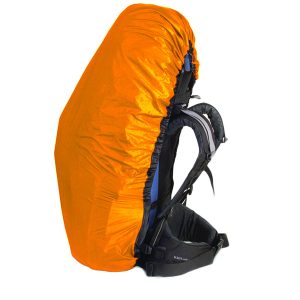 Ultra-Sil Pack Cover Medium Blue
  Body Glide Original - Balm
  Clear Hydration Hint of Lemon
  Queensland State Map