Have you ever thought I just want a map of NSW, the whole state, on one page for my wall to plan my trips! Well, you’ve found it! The reverse side has a more detailed view of the coast from Batemans Bay up to Forster, including campsites and lookouts for Barrington Tops, Wollemi National Park,…
The Grampians region is one of the most popular destinations in Victoria for bushwalking and outdoor recreation. This detailed topographic map contains the latest road and walking trail networks, including the first stage of the new Grampians Peaks Trail, and locations of all the recreation sites in the region. A detailed (1:25,000) map of Halls…
John Chapman and his co-authors spend their lives hiking all over this great land and writing guide books so the rest of us can follow them. Through years of refinement John & Co’s books are well laid-out and colourfully illustrated that detail routes, background, safety, trip planning and further reading.
The New Zealand North Island Map (NZ) is a 1:1,000,000 scale travel reference map of the north island of New Zealand. Marked on the mapping are points of interest, tourist routes, walking tracks and national parks for touring the island. On the reverse are city maps of Auckland, Wellington, Whangarei, Napier, Kerikeri, Hamilton, Gisborne, New Plymouth, Palmerston…
Hema’s regional map of Mid West Western Australia covers from Cape Range National Park south to Mandurah and as far as Kalgoorlie at a scale of 1:1,250,000 that has camping areas, national parks, fuel supplies and facility symbols marked on the map.
These are the official 1:25 000 scale topographical maps from the NSW government Land & Property Division, covering the most outstanding areas of the state on a well-produced, reversible, fold-out map perfect for hikers.
John Chapman and his co-authors spend their lives hiking all over this great land and writing guide books so the rest of us can follow them. Through years of refinement John & Co’s books are well laid-out and colourfully illustrated that detail routes, background, safety, trip planning and further reading.
Looking to do some fun stuff in the Wilsons Promontory region This is the map for you! This map features detailed walk descriptions, including day walks such as the Lilly Pilly Gully, Mt. Oberon and Obern Bay, and overnight walks including Southern Prom and Northern Prom walks. Information on other fun recreational activities including camping,…
This softcover coffee-table style Guidebook reveals the many hidden secrets of the Blue Mountains. Misty, snow dusted landscapes, mysterious amphitheatres, cliff-line waterfalls & waterholes, myriad bushwalking tracks leading to unexpected vistas, cliff-top sunrise brekky spots, plush Hatted restaurants & eclectic coffee shops and the extremist of extreme sports.Within this beautifully designed Guidebook, you’ll find our…
A step up from it’s little brother the Field, the Ranger MS is the go-to tool for most map work on the planet. A longer base plate, magnifying lens and luminous markings build on the strengths of the entry-level model to complete this classic compass model. All Silva compasses include a pamphlet explaining their 1-2-3…
This Cicerone guidebook describes 110 gill and crag scrambling routes in the south of the Lake District, with sections covering Wasdale, Ennerdale and Buttermere, Borrowdale, Thirlmere, Patterdale, Mardale and Swindale. The guidebook includes invaluable of advice on equipment, safety, rope techniques, and scrambling techniques, as well as notes on access and conservation. The Lake District’s…
Hema’s map of the Northern Territory that has camping and rest areas, 24hour fuel and points of interest. On the reverse are through road maps of Darwin and Alice Springs, and a map of the greater Darwin region. For trip planning, there is a national park matrix and contact details for information centres.














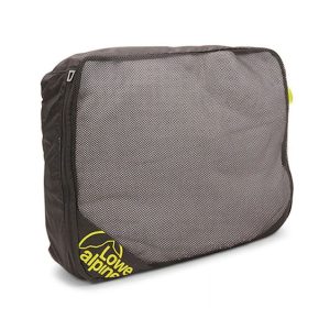 Packing Cube