Journey along dramatic escarpments, across gorgeous rivers and through remote bushland on one of Australia’s historic long-distance walks: The Six Foot Track. This full-colour guide outlines all the info you’ll need to tackle this 44km Blue Mountains classic, including maps, estimated times, details on historic points-of-interest, possible accommodation along the hike and even public transport…
This is one of a series of excellent guide books from the Cicerone. Their guides are an inexpensive option for hikers heading all over the world looking to explore the world’s best walks and treks, mountains and cycle routes. This is a guide to walking the John Muir Trail through California’s High Sierra from Yosemite (El Capitan and…
Had plans to do the Camino this year Maybe your Everest Base Camp trek was cancelled Don’t worry! The Great North Walk is just what you’re looking for! The 250km walk between Newcastle and Sydney is stunning, challenging and right in your backyard. This new section-by-section guide includes full-colour photography, accurate maps, and info on…
Have you ever thought I just want a map of NSW, the whole state, on one page for my wall to plan my trips! Well, you’ve found it! The reverse side has a more detailed view of the coast from Batemans Bay up to Forster, including campsites and lookouts for Barrington Tops, Wollemi National Park,…
A thoroughly revised fourth edition of the bestselling Blue Mountains Best Bushwalks is the perfect companion for the bushwalking fan. The book features: 67 different walks, varying in length from 30 minutes to two days, accurate, full colour maps and step by step directions, detailed walk statistics including distance, total ascent/descent, grade and estimated time,…
John Chapman and his co-authors spend their lives hiking all over this great land and writing guide books so the rest of us can follow them. Through years of refinement John & Co’s books are well laid-out and colourfully illustrated that detail routes, background, safety, trip planning and further reading.
Hema’s regional map of Mid West Western Australia covers from Cape Range National Park south to Mandurah and as far as Kalgoorlie at a scale of 1:1,250,000 that has camping areas, national parks, fuel supplies and facility symbols marked on the map.
Hema’s updated WA State Map is comprised of the most detailed information, which has been verified by Hema Map Patrol. It is printed on waterproof paper and includes a full index of locations, making it durable and easy to use for both navigation and inspiration. On the reverse side of the maps are through road…
A compact map of Queensland (QLD) at a scale of 1:2,500,000 from Hema, for touring throughout the state which features highways, major roads and minor roads. Marked on the map are national parks, camping areas, caravan parks, rest areas, points of interest and 24-hour fuel accompanied by a distance grid and an index.
Cicerone guidebook to 50 day walks in the Mont Blanc region near Chamonix and Courmayeur, plus outlines of 4 multi-day treks around both sides of the Mont Blanc massif. The walks range from 3 to 20km and cover a variety of terrains from easy valley walks to more challenging routes over boulders, scree and on…
This is one of a series of excellent guide books from the Confraternity of Saint James, the pre-eminent, London-based organisation supporting pilgrim activities in Europe. Their guides are an inexpensive option for walkers heading to Santiago de Compostela on any of the many routes across Spain, France and beyond. Each book provides directions and details…
Since the route was opened in 1888, the Milford Track has been described as ‘The finest walk in the world’. Join Almis for this four-day adventure and absorb the Maori myths of Aotearoa, learn about the discovery of Mackinnon’s Pass which led to the establishment of the track, experience the rain, the waterfalls, the climbs…














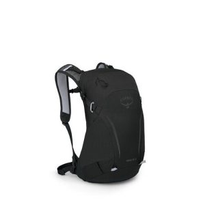 Hikelite 18
  Australian Alps Walking Track