The Exped Seal Sleeve is a range of simple and compact cases that are fully 100% Waterproof and touchscreen compatible. If your next adventure might require you to keep your phone, tablet, wallet, map, money or documents from ending up in the drink – This is the product. Exped has developed a super strong zip…
Cicerone’s inspirational guidebook to 20 treks along the 2400km Himalayan chain. Includes classics such as the treks to Everest and K2 base camps and the Annapurna Circuit. Also epic glacier treks, ultra-long expedition treks and sacred treks. This is a book to inspire and excite, guaranteed to entice any with an adventurous spirit and love of…
John Brierly is one of the acknowledged experts in walking the pilgrim’s routes of the Camino on the Iberian peninsula. For walkers who do not wish to carry the full guide book, and who only require maps, John has produced this map kit, with full daily stage maps, contour guides and town maps to help…
This bestselling bushwalking guide is the perfect companion for the experienced Blue Mountains adventurer, the keen bushwalking beginner and the whole family! Written by Veechi Stuart, a former Sydney Morning Herald columnist and true Blue Mountains local, this guide includes something for everyone. Included:
The Ranger S MS is the older brother of the classic Ranger that we know and love. The S model has a large sighting mirror for 45 angle assistance in taking bearings on distant geographical features, and has cut out the magnifying glass in favour of a shorter nose, producing a smaller bundle that snaps…
This Cicerone guidebook describes 110 gill and crag scrambling routes in the south of the Lake District, with sections covering Wasdale, Ennerdale and Buttermere, Borrowdale, Thirlmere, Patterdale, Mardale and Swindale. The guidebook includes invaluable of advice on equipment, safety, rope techniques, and scrambling techniques, as well as notes on access and conservation. The Lake District’s…
Hema’s iconic large map of Australia is ideal as a trip planning tool and travel companion. Marked on the map are localities, the major road network, distances and major national parks. The map also shows localities, the major road network, distances and major national parks. The visual appeal makes it perfect as a decorative map…
All the mapping you need to complete the 95 mile (153km) West Highland Way, an official Scottish Long Distance Route from Milngavie near Glasgow to Fort William. Showcasing the wild beauty of western Scotland, the trail is a journey from the lowlands to the highlands, passing Loch Lomond then crossing Rannoch Moor before finishing in…
A walker’s guide to the Bogong High Plains, Mt Bogong, Mt Feathertop and Mt Buffalo by Glenn van der Knijff. With its unique user-friendly layout, Victoria’s Bogong High Plains will become an essential reference guide for all walkers. This full-colour, 96 page walking guide is produced in a handy A5 format. Includes
These maps highlight the walking tracks and features tourist information along with general topographic detail and is essential for walkers. The notes on the reverse side introduce visitors to the vegetation, land forms, animals, history of the area, bushwalking tips, safety essentials and booking requirements. Scale: 1:100,000.
















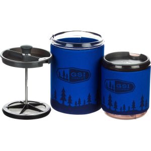 Personal Java Press
 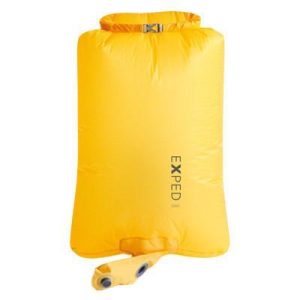 Schnozzel UL - UltralightPump Bag - For Exped Sleeping Mats
  Tikka Core Head Torch
  Walking the Camino Dos Faros