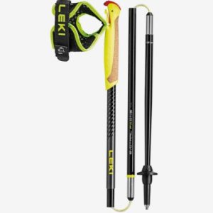
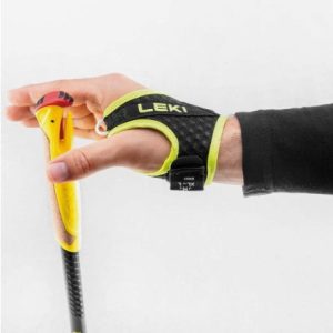
Kick it across every kilometre with the Evotrail FX.One TA running poles by Leki. With a high-strength aluminum construction and the famous Trigger Shark 2.0 system you can enjoy sturdiness on the slopes, impressive transfer of power from your fists to the floor, and easy handling of the comfortable cork grip. With quick, convenient clicking…
This strap is perfect for adding an adjustable shoulder sling to your One Planet travel packs, or other bags. Made in Melbourne with their usual tough construction, the buckle is easy to adjust but stays fast, the 50 mm webbing is super durable and the metal clips at either end are simple to attach. Maximum length…
Printed on waterproof tyvek this tough map covers the Snowy Mountains Main Range on one side at 1:25,000 & Guthega to Round Mountain including Mt Jagungal on the other at 1:50,000 with amazing detailed representation with 10m contour intervals. Also with detailed insets of Watsons Crags, Dead Horse Gap, Blue Lk, Lady Northcote Canyon & marginal…
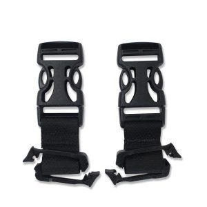
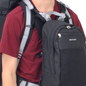
The ONE PLANET daypack front clip is a simple accessory designed to attach any daypack to the harness of a larger pack. Whether your travelling, bushwalking or day walking. Once attached use the simple side release buckles to clip or unclip on the go. Pack of 2.
These are the official 1:25 000 scale topographical maps from the NSW government Land & Property Division, covering the most outstanding areas of the state on a well-produced, reversible, fold-out map perfect for hikers.
This Cicerone guidebook presents 75 day walks of 1 to 26km in South Africa’s Maloti-Drakensberg Park, a UNESCO World Heritage Site. Located in KwaZulu Natal and easily accessible from Johannesburg, Harrismith, Pietermaritzburg and Durban, the region boasts dramatic cliffs, gorges and waterfalls, abundant wildlife and 2000 year old rock paintings.
Cicerone’s Guidebook describing all the trekking routes on Kilimanjaro (5895m), one of the Seven Summits. With 6 ascent routes, 3 summit ascents, the Circuit Path and descent paths, the guide also provides comprehensive information on preparation and access, a route on Mt Meru, as well as information on accommodation and other facilities. This practical guidebook…
The design of the Tasmap 1:50 000 Map Series provides a clear and accurate portrayal of topographic information, with symbols and map content giving enhanced depiction of buildings, hill shading and a simplified classification of vegetation.
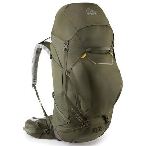
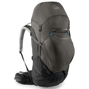
Big adventures require even bigger packs and Lowe Alpine’s Cerro Torre delivers a classic hiking pack design with technical materials, an Axiom 7 harness, plenty of space and a rugged durability that remains weight conscious. This design makes it a comfortable heavy gear hauler for trekking, camping, backpacking and expeditions in the most extreme places….
It may have been been renamed, but the Field MS (formerly Field 7) is still the industry standard compass for schools, scouts and anyone delving into the art of navigation for the first time. The baseplate, rubber grip and common scales will help teach the junior explorer this lifesaving skill. All Silva compasses include a…
The Grampians region is one of the most popular destinations in Victoria for bushwalking and outdoor recreation. This detailed topographic map contains the latest road and walking trail networks, and in depth info for walking, overnight hiking, 4WD touring and other recreational activities. The map also includes a detailed inset of the Mount Abrupt and…











 Water Bottle Pre-Filter