Hema’s map of the Northern Territory that has camping and rest areas, 24hour fuel and points of interest. On the reverse are through road maps of Darwin and Alice Springs, and a map of the greater Darwin region. For trip planning, there is a national park matrix and contact details for information centres.
The Budawangs stands as one of Australia’s most spectacular and distinctive wilderness areas. Using modern elevation, vegetation and trail data, The Budawangs finally delivers a map of quality and accuracy befitting this renowned bushwalking destination. Key features include:
This bestselling bushwalking guide is the perfect companion for the experienced Blue Mountains adventurer, the keen bushwalking beginner and the whole family! Written by Veechi Stuart, a former Sydney Morning Herald columnist and true Blue Mountains local, this guide includes something for everyone. Included:
Cicerone’s essential guidebook for walking the GR5 trail, 660km from Lac Leman (Lake Geneva) to Nice or Menton, through the French Alps. Includes all the main variant routes as it passes Mont Blanc, then through the Vanoise, the Queyras and the Mercantour National Parks. Includes accommodation, profiles and maps. Suitable for fairly experienced hikers.
Best Walks of NSW Mid North Coast covers the mid-north of NSW from south of Port Macquarie to Yamba and boasts a huge range of beautiful environments, making the region perfect for exploring on foot. This book introduces the best walks for visitors and residents alike, ranging from leisurely cliff-top and beach strolls to the…
It’s no good having a map if it’s all soggy – contour lines tend to blur, transforming gentle slopes into towering cliffs. Avoid such topographical catastrophes by protecting your map in this practical map case. The welded design will protect paper from water and dust, and the TPU (thermoplastic polyurethane) is UV resistant and folds…
These are the official 1:25 000 scale topographical maps from the NSW government Land & Property Division, covering the most outstanding areas of the state on a well-produced, reversible, fold-out map perfect for hikers.
Printed on waterproof tyvek this tough map covers the Snowy Mountains Main Range on one side at 1:25,000 & Guthega to Round Mountain including Mt Jagungal on the other at 1:50,000 with amazing detailed representation with 10m contour intervals. Also with detailed insets of Watsons Crags, Dead Horse Gap, Blue Lk, Lady Northcote Canyon & marginal…
Walking & Cycling Canberra’s Centenary Trail introduces the best day walks and cycles for visitors and residents alike, ranging from leisurely urban strolls to the more rugged tracks deep in the bush. Detailed descriptions and maps help the reader explore the parks, bushland, lakes, rivers and most interesting urban areas along the way. The book…
These maps highlight the walking tracks and features tourist information along with general topographic detail and is essential for walkers. The notes on the reverse side introduce visitors to the vegetation, land forms, animals, history of the area, bushwalking tips, safety essentials and booking requirements. Scale: 1:100,000.














 Magnetic Drink Tube Clip
  The Pennine Way From Edale to Kirk
 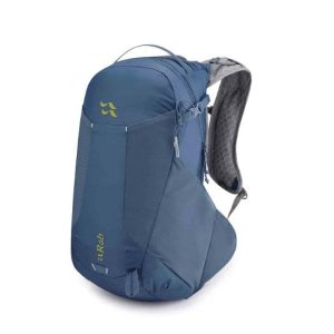 Aeon LT 25 Daypack
  Compass Field Ms