John Chapman and his co-authors spend their lives hiking all over this great land and writing guide books so the rest of us can follow them. Through years of refinement John & Co’s books are well laid-out and colourfully illustrated that detail routes, background, safety, trip planning and further reading.
Printed on waterproof tyvek this tough map covers the Snowy Mountains Main Range on one side at 1:25,000 & Guthega to Round Mountain including Mt Jagungal on the other at 1:50,000 with amazing detailed representation with 10m contour intervals. Also with detailed insets of Watsons Crags, Dead Horse Gap, Blue Lk, Lady Northcote Canyon & marginal…
It’s a map case! You know, you put maps inside to keep them dry, but you can still read them! Actually it’s more than that. The touchscreen compatible TPU screen means that you could conceivably read a map displayed on your tablet, and manipulate it. And don’t fret – its waterproof rating is IPX7 so…
There’s probably no more enjoyable way to learn about English history, the landscape, the folklore and its people, than to embark upon the classic English Coast to Coast Walk, first developed by the great British fell-walker, Alfred Wainwright. Join us as we make our way along this classic walk, which starts from St Bees in…
A walker’s guide to the Bogong High Plains, Mt Bogong, Mt Feathertop and Mt Buffalo by Glenn van der Knijff. With its unique user-friendly layout, Victoria’s Bogong High Plains will become an essential reference guide for all walkers. This full-colour, 96 page walking guide is produced in a handy A5 format. Includes
These Tasmanian maps are recommended for regional planners and visitors intending to travel a little off the beaten track. The map is popular with drivers, cyclists and people wanting a regional overview of an area. The maps are available in folded and flat form and may be joined together to create an impressive wall map.
The New Zealand North Island Map (NZ) is a 1:1,000,000 scale travel reference map of the north island of New Zealand. Marked on the mapping are points of interest, tourist routes, walking tracks and national parks for touring the island. On the reverse are city maps of Auckland, Wellington, Whangarei, Napier, Kerikeri, Hamilton, Gisborne, New Plymouth, Palmerston…
Hema’s regional map of Mid West Western Australia covers from Cape Range National Park south to Mandurah and as far as Kalgoorlie at a scale of 1:1,250,000 that has camping areas, national parks, fuel supplies and facility symbols marked on the map.
The ACR ResQlink 400 Personal Locator Beacon is a small, lightweight and buoyant personal locator beacon. Engineered with military durability and equipped with ResQlink’s satellite precision this unit will not let you down if or when you need it most. You can trust this unit in any environment be it land, sea or sky to…
Hema’s iconic large map of Australia is ideal as a trip planning tool and travel companion. Marked on the map are localities, the major road network, distances and major national parks. The map also shows localities, the major road network, distances and major national parks. The visual appeal makes it perfect as a decorative map…














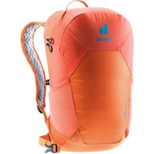 Speed Lite 17
 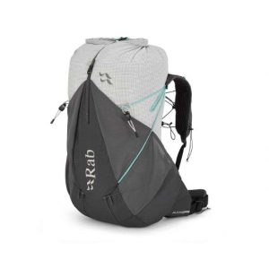 Muon ND 40 - Ultralight Pack - Small Back Length
  West Highland Way Topographical Route Map Booklet