This bestselling bushwalking guide is the perfect companion for the experienced Blue Mountains adventurer, the keen bushwalking beginner and the whole family! Written by Veechi Stuart, a former Sydney Morning Herald columnist and true Blue Mountains local, this guide includes something for everyone. Included:
Cicerone’s excellent guidebook to 22 multi-day treks in the Himalayan Kingdom of Bhutan, including the Jhomolhari, Druk Path and Dagala treks. The trails vary from 2 to 23 days long. The routes are mostly in western and central Bhutan, and range from easy to strenuous depending on the length, altitude and difficulty. Includes advice on cultural…
These Tasmanian maps are recommended for regional planners and visitors intending to travel a little off the beaten track. The map is popular with drivers, cyclists and people wanting a regional overview of an area. The maps are available in folded and flat form and may be joined together to create an impressive wall map.
Cicerone’s comprehensive guidebook and map book to walking the 784km Camino Frances from St Jean-Pied-de-Port in southern France to Santiago de Compostela in Spain, including an additional route to Finisterre. Split into 6 sections and 36 customisable stages, the guide lists over 500 pilgrim hostels. The map book covers the entire route, which can be…
These are the official 1:25 000 scale topographical maps from the NSW government Land & Property Division, covering the most outstanding areas of the state on a well-produced, reversible, fold-out map perfect for hikers.
Hema’s iconic large map of Australia is ideal as a trip planning tool and travel companion. Marked on the map are localities, the major road network, distances and major national parks. The map also shows localities, the major road network, distances and major national parks. The visual appeal makes it perfect as a decorative map…
Since the route was opened in 1888, the Milford Track has been described as ‘The finest walk in the world’. Join Almis for this four-day adventure and absorb the Maori myths of Aotearoa, learn about the discovery of Mackinnon’s Pass which led to the establishment of the track, experience the rain, the waterfalls, the climbs…
John Chapman and his co-authors spend their lives hiking all over this great land and writing guide books so the rest of us can follow them. Through years of refinement John & Co’s books are well laid-out and colourfully illustrated that detail routes, background, safety, trip planning and further reading.
A walker’s guide to the Bogong High Plains, Mt Bogong, Mt Feathertop and Mt Buffalo by Glenn van der Knijff. With its unique user-friendly layout, Victoria’s Bogong High Plains will become an essential reference guide for all walkers. This full-colour, 96 page walking guide is produced in a handy A5 format. Includes
It’s no good having a map if it’s all soggy – contour lines tend to blur, transforming gentle slopes into towering cliffs. Avoid such topographical catastrophes by protecting your map in this practical map case. The welded design will protect paper from water and dust, and the TPU (thermoplastic polyurethane) is UV resistant and folds…
It’s a map case! You know, you put maps inside to keep them dry, but you can still read them! Actually it’s more than that. The touchscreen compatible TPU screen means that you could conceivably read a map displayed on your tablet, and manipulate it. And don’t fret – its waterproof rating is IPX7 so…
This is one of a series of excellent guide books from the Confraternity of Saint James, the pre-eminent, London-based organisation supporting pilgrim activities in Europe. Their guides are an inexpensive option for walkers heading to Santiago de Compostela on any of the many routes across Spain, France and beyond. Each book provides directions and details…















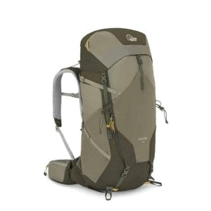 Yacuri 48 Hiking Pack
  DriStore Waterproof Valuables Case Set