A step up from it’s little brother the Field, the Ranger MS is the go-to tool for most map work on the planet. A longer base plate, magnifying lens and luminous markings build on the strengths of the entry-level model to complete this classic compass model. All Silva compasses include a pamphlet explaining their 1-2-3…
John Chapman and his co-authors spend their lives hiking all over this great land and writing guide books so the rest of us can follow them. Through years of refinement John & Co’s books are well laid-out and colourfully illustrated that detail routes, background, safety, trip planning and further reading.
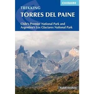
This excellent Cicerone guidebook to walking and trekking in Chile’s Torres del Paine National Park and Argentina’s Los Glaciares National Park, areas of Patagonia. Eight different walks and treks are described, including the 10-11 day Torres del Paine Circuit, one of the world’s great treks, as well as the shorter Half Circuit (4-5 days). The guide…
John Chapman and his co-authors spend their lives hiking all over this great land and writing guide books so the rest of us can follow them. Through years of refinement John & Co’s books are well laid-out and colourfully illustrated that detail routes, background, safety, trip planning and further reading.
A walker’s guide to the Bogong High Plains, Mt Bogong, Mt Feathertop and Mt Buffalo by Glenn van der Knijff. With its unique user-friendly layout, Victoria’s Bogong High Plains will become an essential reference guide for all walkers. This full-colour, 96 page walking guide is produced in a handy A5 format. Includes
Produced by the Department of Lands, this six map kit covers the entire length of the Great North Walk. With details not featured on standard topo maps like convenient camp spots, train stops, drinking water, points of interest and more. It also has a load on insightful info on the back of the maps so…
Journey along dramatic escarpments, across gorgeous rivers and through remote bushland on one of Australia’s historic long-distance walks: The Six Foot Track. This full-colour guide outlines all the info you’ll need to tackle this 44km Blue Mountains classic, including maps, estimated times, details on historic points-of-interest, possible accommodation along the hike and even public transport…
John Chapman and his co-authors spend their lives hiking all over this great land and writing guide books so the rest of us can follow them. Through years of refinement John & Co’s books are well laid-out and colourfully illustrated that detail routes, background, safety, trip planning and further reading.
The Grampians region is one of the most popular destinations in Victoria for bushwalking and outdoor recreation. This detailed topographic map contains the latest road and walking trail networks, and in depth info for walking, overnight hiking, 4WD touring and other recreational activities. The map also includes a detailed inset of the Mount Abrupt and…
Victoria’s multi-day Great Ocean Walk covers 100 kilometres of spectacular scenery and varied hiking from Apollo Bay, around the famous Cape Otway and through to the world famous Twelve Apostles. The route follows the Shipwreck Coast, beside the wild Southern Ocean, as it takes in remote beaches, breath taking views at every turn, unbridged river…
Cicerone’s guidebook to the Via Podiensis (Chemin du Puy) pilgrim route along the GR65 through southern France to the Pyrenees. The 750km route links Le Puy-en-Velay with Saint-Jean-Pied-de-Port and the start of the Camino Frances to Santiago. Includes Cele Valley and Rocamadour variants.
Hema’s regional map of Mid West Western Australia covers from Cape Range National Park south to Mandurah and as far as Kalgoorlie at a scale of 1:1,250,000 that has camping areas, national parks, fuel supplies and facility symbols marked on the map.













 Travel Hammock Wide with Suspension Kit
  Tas Regional Map 125K
  Trekking the GR5 Trail Benelux and Lorraine