Have you ever thought I just want a map of NSW, the whole state, on one page for my wall to plan my trips! Well, you’ve found it! The reverse side has a more detailed view of the coast from Batemans Bay up to Forster, including campsites and lookouts for Barrington Tops, Wollemi National Park,…
Hema’s map of the Northern Territory that has camping and rest areas, 24hour fuel and points of interest. On the reverse are through road maps of Darwin and Alice Springs, and a map of the greater Darwin region. For trip planning, there is a national park matrix and contact details for information centres.
The ACR ResQlink 400 Personal Locator Beacon is a small, lightweight and buoyant personal locator beacon. Engineered with military durability and equipped with ResQlink’s satellite precision this unit will not let you down if or when you need it most. You can trust this unit in any environment be it land, sea or sky to…
Hema’s regional map of Mid West Western Australia covers from Cape Range National Park south to Mandurah and as far as Kalgoorlie at a scale of 1:1,250,000 that has camping areas, national parks, fuel supplies and facility symbols marked on the map.
These Tasmanian maps are recommended for regional planners and visitors intending to travel a little off the beaten track. The map is popular with drivers, cyclists and people wanting a regional overview of an area. The maps are available in folded and flat form and may be joined together to create an impressive wall map.
South-East of Tasmania is one of Australia’s most beautiful regions, and with its stunning scenery and iconic walking tracks it is the perfect place to experience and enjoy on foot. This guide contains a diverse range of walks to explore, including strolls around historic villages, hikes through pristine bushland and rambles along the sparkling, unspoiled…
These are the official 1:25 000 scale topographical maps from the NSW government Land & Property Division, covering the most outstanding areas of the state on a well-produced, reversible, fold-out map perfect for hikers.
This is one of a series of excellent guide books from the Confraternity of Saint James, the pre-eminent, London-based organisation supporting pilgrim activities in Europe. Their guides are an inexpensive option for walkers heading to Santiago de Compostela on any of the many routes across Spain, France and beyond. Each book provides directions and details…
Since the route was opened in 1888, the Milford Track has been described as ‘The finest walk in the world’. Join Almis for this four-day adventure and absorb the Maori myths of Aotearoa, learn about the discovery of Mackinnon’s Pass which led to the establishment of the track, experience the rain, the waterfalls, the climbs…
This Cicerone guidebook describes 110 gill and crag scrambling routes in the south of the Lake District, with sections covering Wasdale, Ennerdale and Buttermere, Borrowdale, Thirlmere, Patterdale, Mardale and Swindale. The guidebook includes invaluable of advice on equipment, safety, rope techniques, and scrambling techniques, as well as notes on access and conservation. The Lake District’s…
















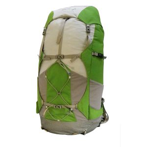 Peak Aspiration Small 50L Pack
 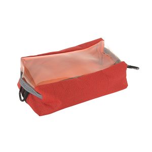 Bath Bag with window
  Day Walks Melbourne