The Expedition now has a sighting mirror! Silva’s Expedition S retains the rugged Dryflex housing, magnetic declination adjustment screw and numerous scale markers of it’s progenitor, but now includes a crystal clear mirror hidden in a defensive case. A must have for the intrepid bush-basher. All Silva compasses include a pamphlet explaining their 1-2-3 map-reading system…
Six Foot Track Map, Informative map covering the 46km long trail from Katoomba to Jenolan Caves. Shows intermediate distances, campsites, facilities and extensive track notes. A NSW Government publication. This map can be laminated and refolded for extra durability in the field.
The design of the Tasmap 1:50 000 Map Series provides a clear and accurate portrayal of topographic information, with symbols and map content giving enhanced depiction of buildings, hill shading and a simplified classification of vegetation.
John Chapman and his co-authors spend their lives hiking all over this great land and writing guide books so the rest of us can follow them. Through years of refinement John & Co’s books are well laid-out and colourfully illustrated that detail routes, background, safety, trip planning and further reading.
Cicerone guidebook for walking the Tour of Mont Blanc, one of the world’s classic treks. The 170km TMB route typically takes 11 days and is described in both anti-clockwise and clockwise directions, with optional variants. Includes information about refuges and facilities and a separate booklet showing the entire route on IGN 1:25,000 maps.
Cicerone’s guidebook has route descriptions for 100 day walks to suit alpine walkers of all abilities, with suggestions for some hut-to-hut tours. These routes take you through breathtaking scenery in the Maritime Alps, Julian Alps, Gran Paradiso, the Turnitzer Alps, Bernese Oberland, the Kitzbuheler Alps and the Dolomites of South Tirol.
This Cicerone guidebook gives stage-by-stage directions for the Central Camino, starting from Lisbon, Porto or Tui, the Coastal Camino between Porto or Vigo, and the Spiritual Variant route from Pontevedra to Redondela. It also describes link routes that can be used to swap from one route to another. Detailed route guidance and maps are accompanied…
John Chapman and his co-authors spend their lives hiking all over this great land and writing guide books so the rest of us can follow them. Through years of refinement John & Co’s books are well laid-out and colourfully illustrated that detail routes, background, safety, trip planning and further reading.
Hema’s map of the Northern Territory that has camping and rest areas, 24hour fuel and points of interest. On the reverse are through road maps of Darwin and Alice Springs, and a map of the greater Darwin region. For trip planning, there is a national park matrix and contact details for information centres.
John and Monica Chapman spend their lives hiking all over this great land and writing guide books so the rest of us can follow them. Through years of refinement their range of books offer insightful observations and background on numerous trails across Australia. John and Monica’s books are well laid-out, colourfully illustrated and provide extensive information…
John Brierly is one of the acknowledged experts in walking the pilgrim’s route of the Camino Frances, Way of St. James, or Camino de Santiago, in northern Spain. For walkers who do not wish to carry the full guide book, and who only require maps, John has produced this map kit, with full daily stage…
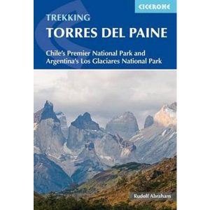
This excellent Cicerone guidebook to walking and trekking in Chile’s Torres del Paine National Park and Argentina’s Los Glaciares National Park, areas of Patagonia. Eight different walks and treks are described, including the 10-11 day Torres del Paine Circuit, one of the world’s great treks, as well as the shorter Half Circuit (4-5 days). The guide…













 Walking the Coast to Coast Walk - St Bees to Robin Hoods Bay - 4th Edition