West MacDonnell Ranges and Larapinta Trail Map Kit
$67.50The West MacDonnell Ranges and the Larapinta Trail map is just what you need when you’re taking on this epic 230km trail. Features include:

Showing 1–12 of 28 results

The West MacDonnell Ranges and the Larapinta Trail map is just what you need when you’re taking on this epic 230km trail. Features include:

Six Foot Track Map, Informative map covering the 46km long trail from Katoomba to Jenolan Caves. Shows intermediate distances, campsites, facilities and extensive track notes. A NSW Government publication. This map can be laminated and refolded for extra durability in the field.


Produced by the Department of Lands, this six map kit covers the entire length of the Great North Walk. With details not featured on standard topo maps like convenient camp spots, train stops, drinking water, points of interest and more. It also has a load on insightful info on the back of the maps so…

These are the official 1:25 000 scale topographical maps from the NSW government Land & Property Division, covering the most outstanding areas of the state on a well-produced, reversible, fold-out map perfect for hikers.

Hema’s iconic large map of Australia is ideal as a trip planning tool and travel companion. Marked on the map are localities, the major road network, distances and major national parks. The map also shows localities, the major road network, distances and major national parks. The visual appeal makes it perfect as a decorative map…

Have you ever thought I just want a map of NSW, the whole state, on one page for my wall to plan my trips! Well, you’ve found it! The reverse side has a more detailed view of the coast from Batemans Bay up to Forster, including campsites and lookouts for Barrington Tops, Wollemi National Park,…

Hema’s regional map of Mid West Western Australia covers from Cape Range National Park south to Mandurah and as far as Kalgoorlie at a scale of 1:1,250,000 that has camping areas, national parks, fuel supplies and facility symbols marked on the map.

A compact map of Queensland (QLD) at a scale of 1:2,500,000 from Hema, for touring throughout the state which features highways, major roads and minor roads. Marked on the map are national parks, camping areas, caravan parks, rest areas, points of interest and 24-hour fuel accompanied by a distance grid and an index.

Hema’s updated WA State Map is comprised of the most detailed information, which has been verified by Hema Map Patrol. It is printed on waterproof paper and includes a full index of locations, making it durable and easy to use for both navigation and inspiration. On the reverse side of the maps are through road…


It’s no good having a map if it’s all soggy – contour lines tend to blur, transforming gentle slopes into towering cliffs. Avoid such topographical catastrophes by protecting your map in this practical map case. The welded design will protect paper from water and dust, and the TPU (thermoplastic polyurethane) is UV resistant and folds…

Looking to do some fun stuff in the Wilsons Promontory region This is the map for you! This map features detailed walk descriptions, including day walks such as the Lilly Pilly Gully, Mt. Oberon and Obern Bay, and overnight walks including Southern Prom and Northern Prom walks. Information on other fun recreational activities including camping,…

These are the official 1:25 000 scale topographical maps from the NSW government Land & Property Division, covering the most outstanding areas of the state on a well-produced, reversible, fold-out map perfect for hikers.
End of content
End of content
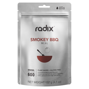 Plant Based - Smokey Barbecue - Original 600 Meal
1 × $52.98
Plant Based - Smokey Barbecue - Original 600 Meal
1 × $52.98 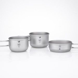 3-Piece Titanium pot and Pan Cook Set - 6053
1 × $80.38
3-Piece Titanium pot and Pan Cook Set - 6053
1 × $80.38  Northern Grampians - 1-50000
1 × $54.90
Northern Grampians - 1-50000
1 × $54.90 Subtotal: $188.26